What is a hedge? According to a recent definition, “any boundary line of trees and/or shrubs over 20m long and less than 5m wide, where any gaps between the trees or shrub species are less that 20m wide, and where native woody species form 80% or more of the cover. Any bank, wall, ditch or tree within 2m of the centre of the hedgerow is considered to be part of the hedgerow, as is the herbaceous vegetation within 2m of the centre of the hedgerow”1. We have a lot of them, although it is estimated that between 30 – 50 percent of Britain’s hedgerows were lost between the 1940s and 1990s, mostly in England, due to development and agricultural intensification2. A new threat has emerged in recent years from lack of maintenance resulting in gappy hedges or overgrown lines of trees.
The quality of hedgerows determines how well hedgerows enhance biodiversity. Hedgerow height and width, the provision of flowers (for pollinators) and berries (for overwintering birds), the presence of mature trees, and the density and structural diversity of the hedgerow network are all examples of quality attributes which affect how well hedgerows can support wildlife. Recent research suggests that we need many more hedgerows (an extra 335 000 km, bringing the total length in England to 882 000 km or 10 km / km2), if we are to achieve Favourable Conservation Status (FCS)1. One hedgerow standard tree is required every 40m of hedgerow length to achieve FCS, a 14-fold increase in the current estimate of 1.6 million hedgerow trees!
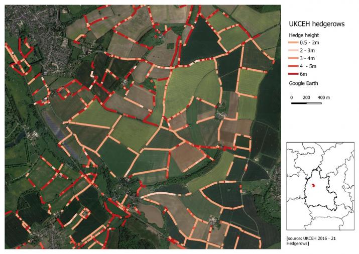
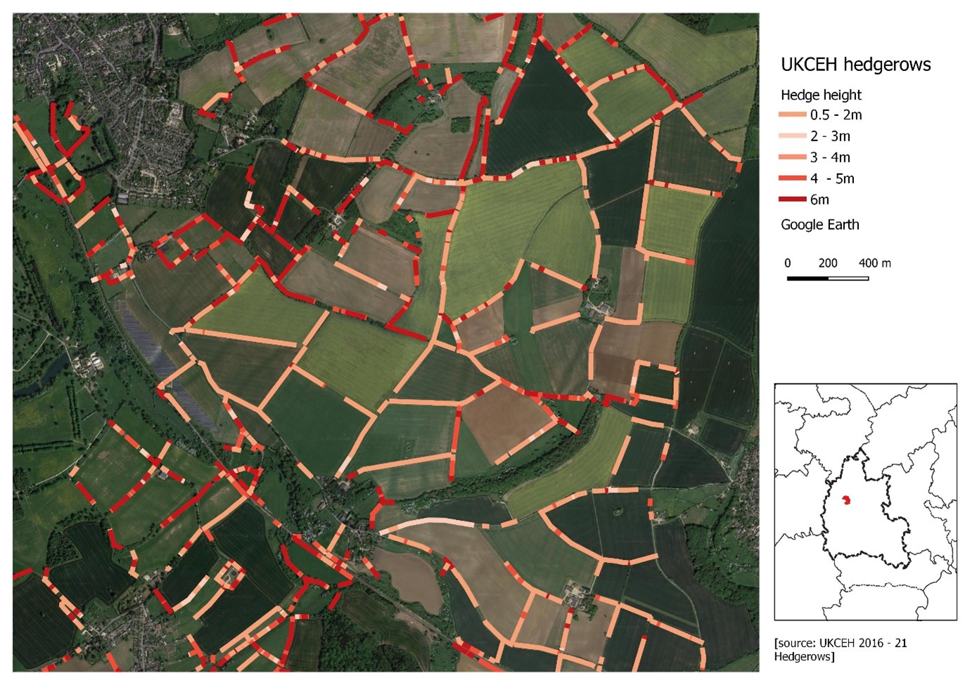
The UK Centre for Ecology and Hydrology (UKCEH) have recently produced an exciting new map of hedgerows from LiDAR imagery supplied by the Environment Agency (EA)3. EA supplied a 1m x,y resolution (1cm vertical z-resolution) Canopy Height Model (CHM) for England, pre-processed by subtracting the Digital Terrain Model (DTM) from the first-return Digital Surface Model (DSM). The new dataset estimates that there are about 390 000 km of hedgerows between 1 – 6m in height, in England. The technical details of how the ‘Hedgerows (2016-2021) England’ dataset was generated can be found in the documentation associated with the data download (for which a license is required, although data are freely available for education/research) [see: https://catalogue.ceh.ac.uk/documents/d90a3733-2949-4dfa-8ac2-a88aef8699be]. Hedgerow density is highly variable spatially, with the SW showing the greatest density at 5.1 km per 1km x 1km square1. Additionally, CEH mapped another 67,000 km of lines of vegetation below 1m, which may be degraded, cut or newly-planted hedges, and a further 185,000 km above 6m tall, which includes mature hedgerow trees and many overgrown hedges.
UKCEH carried out on-site field surveys to check the mapping and found there was a 96% accuracy when comparing total length of hedgerows across all 1km x 1km squares surveyed. I looked at a sample of the dataset for an area of West Oxfordshire I know well and where a local community group are developing a nature recovery plan. The sample I show here (Charlbury can be seen in the NW corner), confirms this visually with only a few false negatives (missing hedges) and some misalignment (compared with Google Earth, in this case), probably resulting from smoothing. The map shows hedgerow height, but the data can also show the difference between double (i.e., both sides of a road/track) and single hedge lines, and length.
An important missing element are hedgerow trees. Recently, Google have developed an experimental data set for sample areas in the UK that also includes hedgerow trees, isolated trees and hedgerow width (pers comm). Overall, the UK CEH data set provides a fantastic resource. Dr Richard Broughton who led the UKCEH work, says “Hedgerows are not only an intrinsic part of England’s rural heritage, they can also be a real asset in helping to tackle the biodiversity and climate crises.” In this part of West Oxfordshire as part of nature recovery, we will benefit hugely from the new hedgerow data, allowing us to develop targets for new hedgerow planting and restoration.
Geoff Griffiths