
ialeUK 2016 Student Workshop
University of Edinburgh, 18-19 May 2016
Participatory GIS is the process of dealing with geographical information with community members and other stakeholders. People can be involved either in the production or use of geographical information.This year’s ialeUK student workshop was for all students who are interested in or already using participatory GIS methods in their research. It provided an opportunity for students to explore a range of techniques for producing and using GIS with people.
- tools for decision-making and spatial planning
- ecosystem service assessments and valuations
- collecting local or expert knowledge
- understanding landscape and seascape values
Sessions with partners from Countryscape, University of Edinburgh, University of Manchester, University of York, Forest Research and NAFC Marine Centre put the training into policy, planning and practical contexts.
Presentations
- Jonathan Porter, Countryscape - Introduction to pGIS (file coming soon)
- Pedro Zorrilla Miras, University of Edinburgh - Participatory research using pGIS and BBNs (file coming soon)
- Richard Kingston, University of Manchester - pGIS: Theory, methods and applications
- John Forrester, University of York - Participatory design and designing for participation
- Charlotte Slater, NAFC Marine Centre - Using pGIS to enhance marine spatial planning in Shetland
-
Chloe Bellamy, Forest Research - pGIS tools for applying ecosystem approach – case study from Strathard using MapMe
-
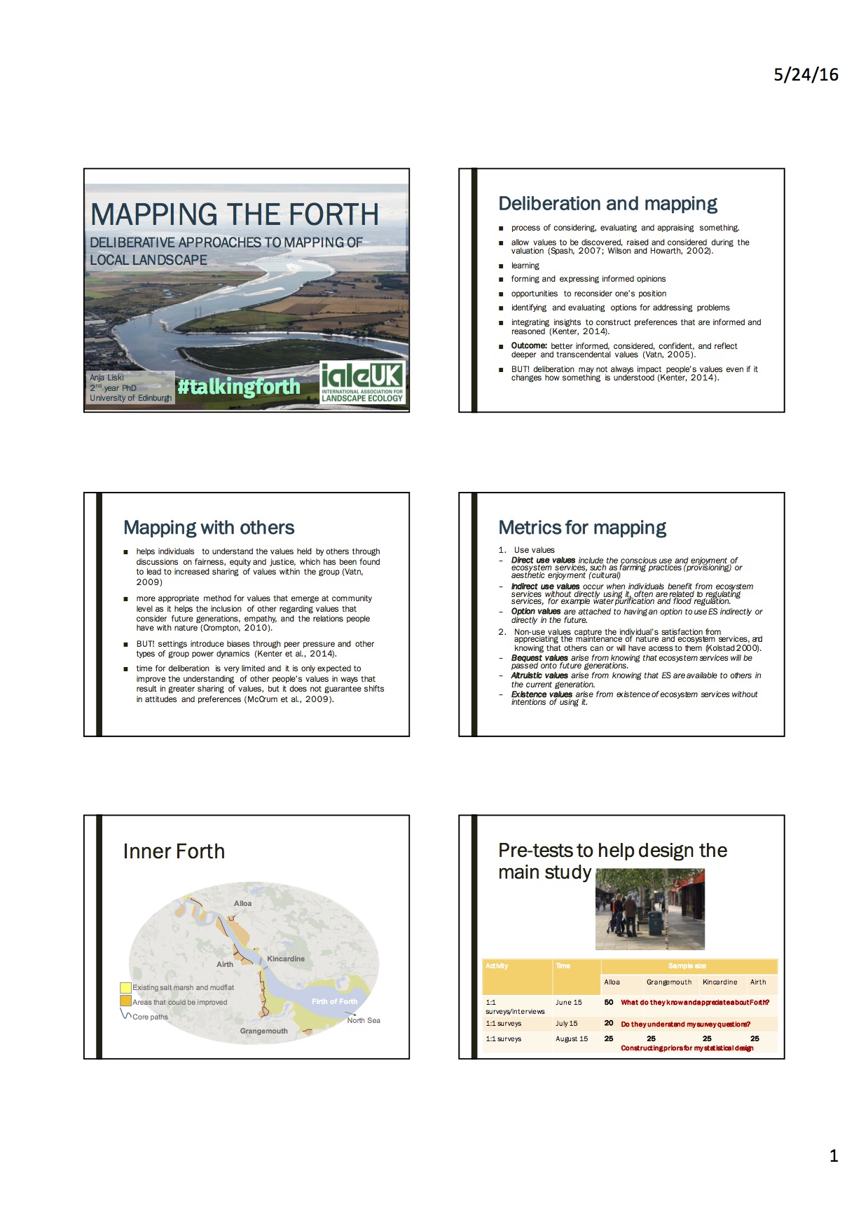
Anja Liski, University of Edinburgh - Deliberative pGIS for ecosystem service valuation – lessons learnt in the Inner Forth
Key background readings for Richard Kingston's session:
-
White, Kingston and Barker (2010) Participatory GIS for developing flood risk management policy options. Journal of Flood Risk Management. 3(4):337-346.
-
Other paper’s written by Richard can be found here
- Latest system Richard has developed for the Joseph Rowntree Foundation is here
Key background readings for John Forrester's session:
-
Forrester, Taylor, Greaves and Noble (2014) Modelling Social-Ecological Problems in Coastal Ecosystems: A Case Study. Complexity 19: 73-82
-
Forrester and Gerger Swartling (eds.) 2010. Overcoming the Challenges of ‘Doing Participation’ in Environment and Development: Workshop Summary of Lessons Learned and Ways Forward.
- Forrester, 2008. The DISTILLATE Guide to Cross-sectoral and Intra-organisational Partnership Working for Sustainable Transport Decision Making. http://www.distillate.ac.uk/outputs/D1%20guide%20to%20partnership%20working%20(14-04-08).pdf (look particularly at decision tree 2 on page 8)
- Forrester, Cook, Bracken, Cinderby and Donaldson, 2105. Combining participatory mapping with Q-methodology to map stakeholder perceptions of complex environmental problems. Applied Geography 56: 199-208.